LiDAR Technology Companies: Shaping the Future
LiDAR technology companies are at the forefront of a revolution, harnessing the power of light to map the world with unprecedented accuracy. This technology, which uses lasers to measure distances […]
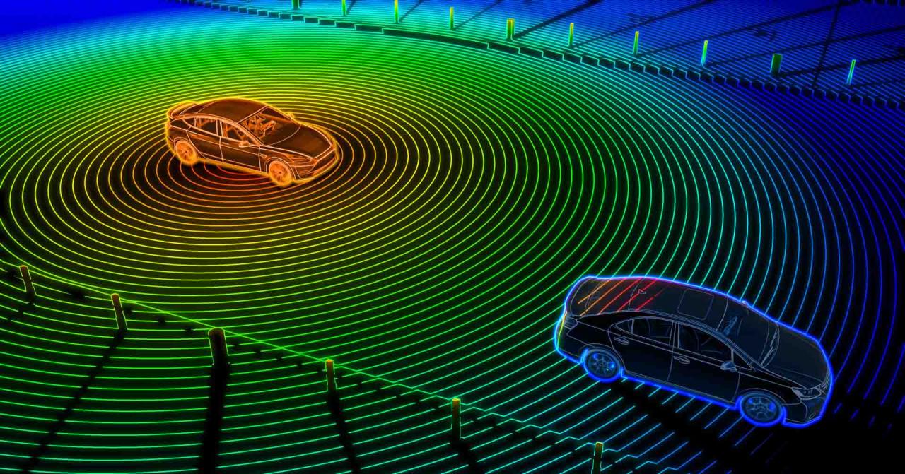
LiDAR technology companies are at the forefront of a revolution, harnessing the power of light to map the world with unprecedented accuracy. This technology, which uses lasers to measure distances and create detailed 3D models, is rapidly transforming industries from autonomous vehicles to mapping and surveying.
LiDAR systems emit laser pulses that bounce off objects and return to a sensor, providing precise measurements of distance and position. This data is then processed to create detailed 3D representations of the environment, offering a wealth of information for various applications.
Introduction to LiDAR Technology

LiDAR, which stands for Light Detection and Ranging, is a remote sensing technology that utilizes laser pulses to measure distances to objects and create detailed 3D maps of the surrounding environment. It plays a crucial role in various fields, including autonomous vehicles, mapping, and surveying.
LiDAR technology operates based on the principle of time-of-flight measurement. A LiDAR system emits laser pulses, and the time it takes for these pulses to travel to an object and return to the sensor is measured. The distance to the object is calculated based on the speed of light and the travel time.
Key Components of a LiDAR System
LiDAR systems consist of several key components that work together to acquire and process data:
- Laser Scanner: The laser scanner emits laser pulses that are directed towards the target. It is responsible for generating and controlling the laser beam.
- Receiver: The receiver detects the reflected laser pulses and converts them into electrical signals. It is responsible for capturing the returning light.
- Signal Processor: The signal processor analyzes the received signals and calculates the time-of-flight for each pulse. It determines the distance to the target.
- Positioning System: A positioning system, such as GPS or IMU, provides accurate location and orientation information for the LiDAR system. This allows for the creation of georeferenced 3D maps.
- Data Acquisition System: The data acquisition system collects and stores the measured distances and other relevant data. It is responsible for managing the data flow and recording the measurements.
Real-World Applications of LiDAR Technology
LiDAR technology has numerous applications in various industries, including:
- Autonomous Vehicles: LiDAR sensors are crucial for self-driving cars, providing real-time 3D perception of the environment. They enable vehicles to detect obstacles, navigate roads, and avoid collisions.
- Mapping and Surveying: LiDAR is widely used in mapping and surveying to create highly accurate and detailed 3D models of landscapes, buildings, and infrastructure. It allows for precise measurements of terrain elevation, vegetation density, and building dimensions.
- Construction and Engineering: LiDAR is employed in construction and engineering projects for site surveys, volume calculations, and monitoring of construction progress. It provides accurate data for planning, design, and execution of projects.
- Agriculture: LiDAR is used in precision agriculture to assess crop health, monitor field conditions, and optimize irrigation and fertilization. It helps farmers improve yield and resource management.
- Forestry: LiDAR is utilized in forestry to measure tree height, canopy density, and forest biomass. It provides valuable information for forest management, carbon sequestration, and wildfire prevention.
- Archaeology: LiDAR is employed in archaeological research to map ancient sites, identify buried structures, and understand past landscapes. It allows for non-invasive exploration of archaeological features.
Types of LiDAR Systems
LiDAR systems can be broadly categorized based on their scanning methods, which directly impact their performance, applications, and cost. These methods determine how the laser beam is directed and how the data is collected, influencing the resolution, accuracy, and range of the system.
Mechanical LiDAR Systems
Mechanical LiDAR systems use a rotating mirror or prism to scan the laser beam across a scene. This allows them to collect data from a wide area, but it also makes them bulky and susceptible to vibration.
- Advantages: Mechanical LiDAR systems offer high resolution and accuracy due to their precise scanning mechanisms. They are also capable of capturing data over long ranges, making them suitable for applications such as surveying and mapping.
- Disadvantages: Mechanical LiDAR systems are generally more expensive than solid-state systems. Their bulky design makes them less portable and more susceptible to vibration, which can affect the quality of the data. They also require more time to collect data due to their scanning motion.
- Examples: Airborne LiDAR systems used for mapping large areas, terrestrial LiDAR systems used for surveying and construction, and mobile LiDAR systems used for autonomous driving.
Solid-State LiDAR Systems, Lidar technology companies
Solid-state LiDAR systems use electronic components, such as MEMS (Micro-Electro-Mechanical Systems) or optical phased arrays, to steer the laser beam. This eliminates the need for moving parts, making them smaller, lighter, and more robust.
- Advantages: Solid-state LiDAR systems are more compact and portable than mechanical systems. They are also less susceptible to vibration, resulting in more stable and accurate data. Additionally, they can be faster and more efficient in data acquisition due to their electronic scanning mechanisms.
- Disadvantages: Solid-state LiDAR systems generally have a shorter range and lower resolution than mechanical systems. They can also be more expensive, especially for high-performance systems.
- Examples: Automotive LiDAR systems used for autonomous driving, handheld LiDAR scanners used for 3D modeling, and mobile LiDAR systems used for mapping and inspection.
Comparison of LiDAR System Types
The following table summarizes the key features of different LiDAR system types:
| Feature | Mechanical LiDAR | Solid-State LiDAR |
|---|---|---|
| Scanning Method | Rotating mirror or prism | MEMS or optical phased arrays |
| Resolution | High | Medium to low |
| Range | Long | Short to medium |
| Accuracy | High | Medium to high |
| Size and Weight | Large and heavy | Small and light |
| Cost | High | Medium to high |
| Applications | Surveying, mapping, autonomous driving | Autonomous driving, 3D modeling, mapping, inspection |
Applications of LiDAR Technology: Lidar Technology Companies
LiDAR technology has emerged as a transformative force across numerous industries, revolutionizing the way we perceive and interact with our environment. Its ability to accurately measure distances and create detailed 3D models has opened up a wide range of applications, from autonomous vehicles to precision agriculture.
Autonomous Vehicles
LiDAR plays a crucial role in the development of autonomous vehicles, providing the critical “eyes” that enable these vehicles to navigate their surroundings safely and efficiently.
- Obstacle Detection and Avoidance: LiDAR sensors emit laser pulses that bounce off objects in the environment, allowing the vehicle to detect obstacles, such as cars, pedestrians, and traffic signs, in real-time. This information is then used to generate a 3D map of the surroundings, enabling the vehicle to navigate safely and avoid collisions. For example, Waymo, a leading autonomous vehicle company, utilizes LiDAR technology to create detailed 3D maps of urban environments, allowing its vehicles to navigate complex intersections and crowded streets with precision.
- Lane Keeping and Adaptive Cruise Control: LiDAR sensors can also detect lane markings and other vehicles on the road, enabling autonomous vehicles to maintain their lane and adjust their speed accordingly. This technology enhances safety and improves the overall driving experience. For instance, Tesla’s Autopilot system uses LiDAR, along with other sensors, to provide lane keeping assistance and adaptive cruise control, allowing the vehicle to maintain a safe distance from other vehicles.
Mapping and Surveying
LiDAR technology has revolutionized mapping and surveying, providing highly accurate and detailed 3D models of various environments.
- Topographical Mapping: LiDAR can be used to create precise topographical maps of large areas, capturing detailed elevation data and identifying terrain features. This information is valuable for various applications, including infrastructure planning, disaster management, and environmental monitoring. For example, the National Oceanic and Atmospheric Administration (NOAA) uses LiDAR to map coastal areas, providing critical data for flood risk assessment and coastal erosion management.
- Urban Planning and Development: LiDAR technology plays a significant role in urban planning and development, providing detailed 3D models of cities and towns. This information is used to optimize infrastructure planning, manage traffic flow, and develop sustainable urban environments. For instance, the city of San Francisco utilizes LiDAR to create 3D models of the city, enabling planners to analyze traffic patterns, identify potential infrastructure bottlenecks, and develop strategies for improving urban mobility.
Robotics
LiDAR technology empowers robots with enhanced perception and navigation capabilities, enabling them to operate in complex and dynamic environments.
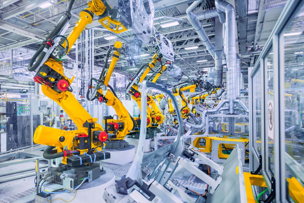
- Industrial Automation: LiDAR sensors are used in industrial robotics for tasks such as material handling, assembly, and inspection. They provide robots with precise 3D vision, allowing them to identify objects, navigate obstacles, and perform tasks with high accuracy. For example, Amazon utilizes LiDAR technology in its warehouses to enable robots to navigate aisles, pick up packages, and transport them to designated locations, significantly improving warehouse efficiency.
- Search and Rescue: LiDAR-equipped robots can be deployed in search and rescue operations to navigate hazardous environments, such as collapsed buildings or disaster zones. They can scan the environment, identify victims, and provide valuable information to rescue teams. For instance, the Boston Dynamics Spot robot, equipped with LiDAR, was used in the aftermath of the 2017 earthquake in Mexico to assess damage and locate survivors.
Future Trends in LiDAR Technology
![]()
LiDAR technology is rapidly evolving, driven by advancements in sensor design, processing power, and integration with other technologies. These advancements are leading to miniaturization, cost reduction, and enhanced capabilities, paving the way for new applications and a wider adoption of LiDAR across various industries.
Miniaturization and Cost Reduction
Miniaturization and cost reduction are key drivers of LiDAR’s widespread adoption. The miniaturization of LiDAR sensors enables their integration into smaller devices, such as smartphones and drones, making them more accessible and versatile. Cost reduction is achieved through advancements in manufacturing processes, the use of cheaper materials, and the development of more efficient sensor designs.
- Smaller Form Factors: LiDAR sensors are becoming increasingly compact, enabling their integration into smaller devices like smartphones, drones, and autonomous vehicles. This miniaturization allows for a wider range of applications, from mobile mapping and 3D modeling to object detection and navigation.
- Lower Production Costs: Advancements in manufacturing processes, the use of cheaper materials, and the development of more efficient sensor designs have led to a significant reduction in the cost of LiDAR sensors. This makes LiDAR technology more accessible to a wider range of industries and applications.
Integration with Other Sensors
The integration of LiDAR with other sensors, such as cameras, radar, and GPS, is enhancing its capabilities and expanding its applications. This integration allows for the creation of more comprehensive and accurate datasets, improving object detection, mapping, and navigation.
- Sensor Fusion: LiDAR data can be combined with data from other sensors, such as cameras and radar, to create a more comprehensive understanding of the environment. This sensor fusion approach improves object detection, classification, and tracking, leading to more robust and reliable autonomous systems.
- Enhanced Perception: The integration of LiDAR with other sensors allows for the creation of more detailed and accurate 3D models of the environment. This enhanced perception is crucial for applications such as autonomous navigation, robotics, and industrial automation.
Advancements in Processing Power
Advancements in processing power have significantly improved the speed and accuracy of LiDAR data processing. This allows for real-time analysis and decision-making, enabling applications such as autonomous driving and robotics.
- Real-Time Processing: The development of more powerful processors and specialized hardware has enabled real-time processing of LiDAR data. This is essential for applications that require immediate responses, such as autonomous driving and robotics.
- Improved Accuracy: Faster processing speeds allow for more sophisticated algorithms to be used for data analysis, leading to improved accuracy in object detection, mapping, and other applications.
Applications in Various Industries
The ongoing advancements in LiDAR technology are driving its adoption across a wide range of industries. From autonomous vehicles and robotics to agriculture and healthcare, LiDAR is transforming how we perceive and interact with the world.
- Autonomous Vehicles: LiDAR is a crucial component in autonomous vehicles, providing accurate 3D perception of the surrounding environment. It enables self-driving cars to navigate safely and efficiently in complex urban environments.
- Robotics: LiDAR is used in robotics for navigation, object detection, and manipulation. It enables robots to operate in complex and dynamic environments, such as warehouses, factories, and construction sites.
- Agriculture: LiDAR is used in precision agriculture to create detailed 3D models of farm fields, allowing farmers to optimize planting, fertilization, and harvesting processes.
- Healthcare: LiDAR is used in healthcare for applications such as 3D body scanning, surgical planning, and disease diagnosis.
Timeline of Key Milestones
| Year | Milestone |
|---|---|
| 1960s | Early development of LiDAR technology for atmospheric research. |
| 1970s | First use of LiDAR for remote sensing applications. |
| 1980s | Development of solid-state LiDAR sensors. |
| 1990s | Increased use of LiDAR in mapping and surveying applications. |
| 2000s | Advancements in LiDAR technology lead to wider adoption in various industries. |
| 2010s | Rapid growth of LiDAR applications in autonomous vehicles, robotics, and other fields. |
| 2020s | Continued miniaturization, cost reduction, and integration with other sensors, driving widespread adoption of LiDAR. |
End of Discussion
As LiDAR technology continues to advance, we can expect to see even more innovative applications emerge. From self-driving cars to precision agriculture, the potential of LiDAR is vast. The companies leading this revolution are pushing the boundaries of what’s possible, shaping a future where our understanding of the world is enhanced by the power of light.
Lidar technology companies are rapidly expanding, with a focus on applications in autonomous vehicles, mapping, and more. One notable player in this field is troy technologies inc , known for its expertise in high-performance lidar systems. The company’s commitment to innovation and cutting-edge solutions positions it as a key contributor to the advancement of lidar technology.
